The best nature outings with kids in Puerto Rico
Ordered by the Family profile · 20 places
Not every nature outing needs a long hike. This ranking puts first the places that are easy and safe for children: short trails, observation towers, visitor centres and pools with easy access, with a bit of swimming and culture as a bonus.
El Yunque concentrates many of them, but there are good options in every region. Even on short trails, bring water, insect repellent and shoes with grip, and remember that rivers rise quickly after rain.
- 1
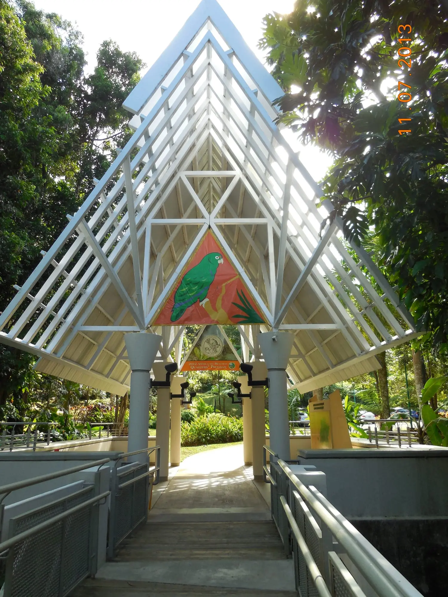
El Portal
88/100Visitor center · Río Grande · East coastNot verified: Scores estimated from public sources, pending an on-site check: they may change.El Yunque's visitor center at the forest entrance, with exhibits on the rainforest, a short accessible walkway and a shop.
- Ease
- Safety
- Access
- 2
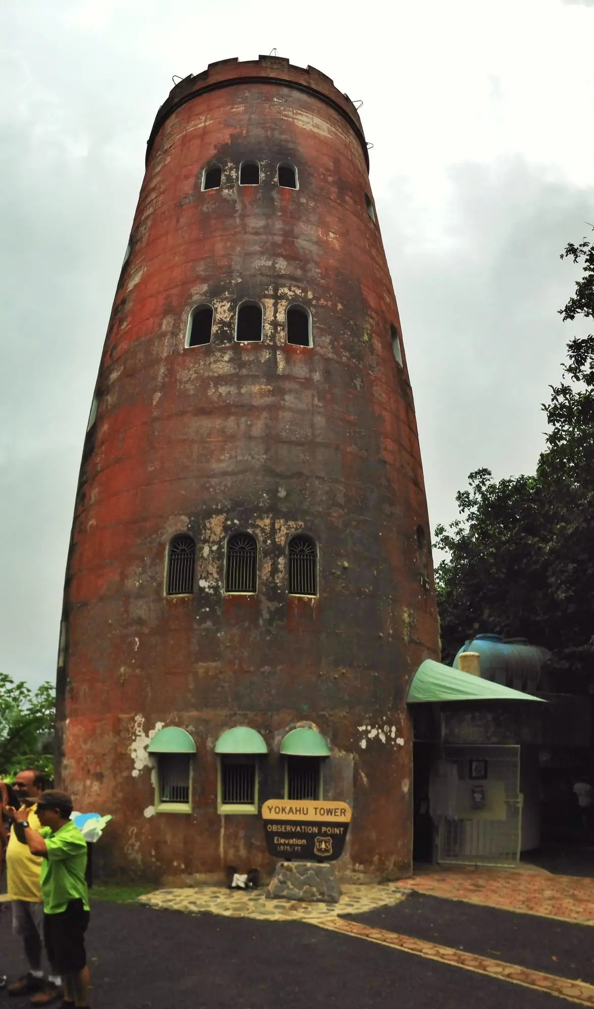
Torre de Yokahú
85/100Viewpoint · Río Grande · East coastNot verified: Scores estimated from public sources, pending an on-site check: they may change.A 1960s stone observation tower by the PR-191, with views over the forest canopy to the Luquillo coast and the islands off Fajardo.
- Ease
- Safety
- Access
- 3Visitor center · Río Grande · East coastNot verified: Scores estimated from public sources, pending an on-site check: they may change.
Information centre on the PR-191 in the heart of El Yunque, in a palo colorado forest, where the trails to La Mina and Baño de Oro start.
- Ease
- Safety
- Access
- 4
Cerro Maravilla
80/100Viewpoint · Ponce · Central mountainsNot verified: Scores estimated from public sources, pending an on-site check: they may change.One of the highest peaks of the island (1,170 m), with a road to the top, sweeping views and a memorial to the two young independence activists killed here in 1978.
- Ease
- Safety
- Access
- 5
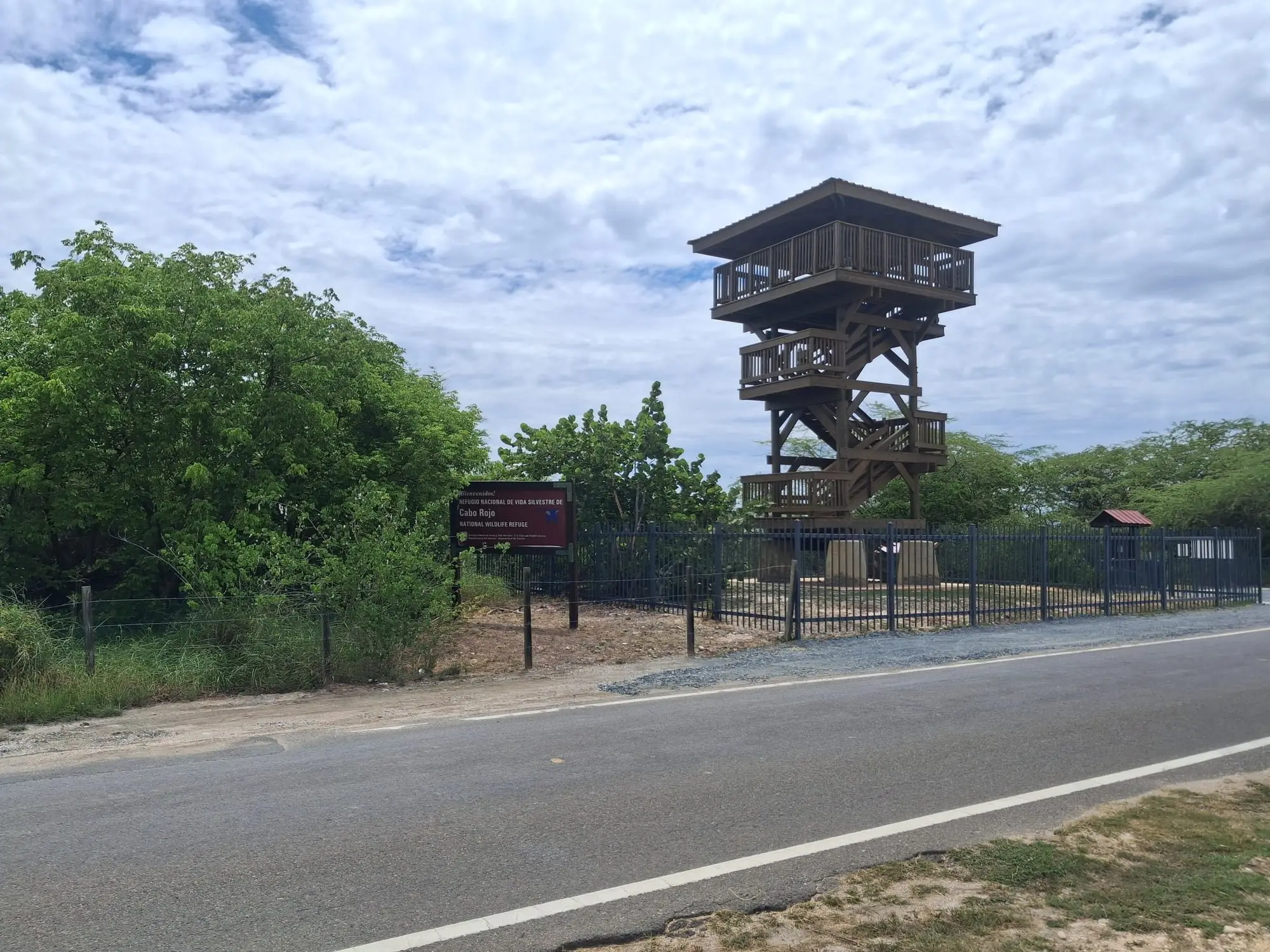
Mirador de las Salinas
80/100Viewpoint · Cabo Rojo · West coastNot verified: Scores estimated from public sources, pending an on-site check: they may change.An observation tower over the pink salt ponds of Cabo Rojo, next to the interpretive center, ideal for watching shorebirds.
- Ease
- Safety
- Access
- 6
Sumidero Tres Pueblos
80/100Cave · Lares · North coastNot verified: Scores estimated from public sources, pending an on-site check: they may change.A huge sinkhole where the borders of Camuy, Hatillo and Lares meet, with a viewing platform over the Río Camuy flowing more than 100 m below.
- Ease
- Safety
- Access
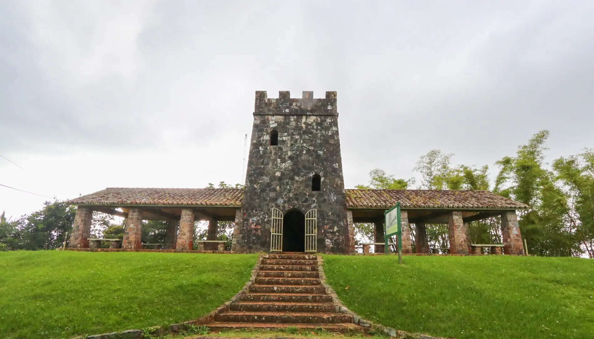
- 7Viewpoint · Maricao · West coastNot verified: Scores estimated from public sources, pending an on-site check: they may change.
A stone observation tower from the 1930s next to the road through the Maricao forest, with one of the widest views of western Puerto Rico.
- Ease
- Safety
- Access
- 8Trail · San Juan · San Juan metroNot verified: Scores estimated from public sources, pending an on-site check: they may change.
A short, easy trail with information panels through the San Patricio forest, in the middle of San Juan, good for a walk or birding.
- Ease
- Safety
- Access
- 9Bioluminescent bay · Lajas · West coastNot verified: Scores estimated from public sources, pending an on-site check: they may change.
The bioluminescent bay of La Parguera, reached by boat from the village pier in a few minutes. Its glow is fainter than in Vieques, but here you can usually swim in it.
- Ease
- Safety
- Access
- 10
Puente Roto
75/100Swimming hole · Río Grande · East coastNot verified: Scores estimated from public sources, pending an on-site check: they may change.A popular swimming spot on the Río Mameyes at the foot of El Yunque, next to the remains of an old bridge, with easy access from the road.
- Ease
- Safety
- Access
- 11
Salto Collazo
75/100Waterfall · San Sebastián · North coastNot verified: Scores estimated from public sources, pending an on-site check: they may change.A waterfall in San Sebastián that can be seen from the road, with a small park next to it; a quick stop on a drive through the west.
- Ease
- Safety
- Access
- 12Viewpoint · Isabela · West coastNot verified: Scores estimated from public sources, pending an on-site check: they may change.
An observation tower next to the ranger office of the Guajataca forest, where several trails start, with views over the karst hills.
- Ease
- Safety
- Access
- 13Trail · Salinas · South coastNot verified: Scores estimated from public sources, pending an on-site check: they may change.
An easy interpretive trail with boardwalks through mangroves and coastal forest in the Jobos Bay reserve, near the visitor centre.
- Ease
- Safety
- Access
- 14
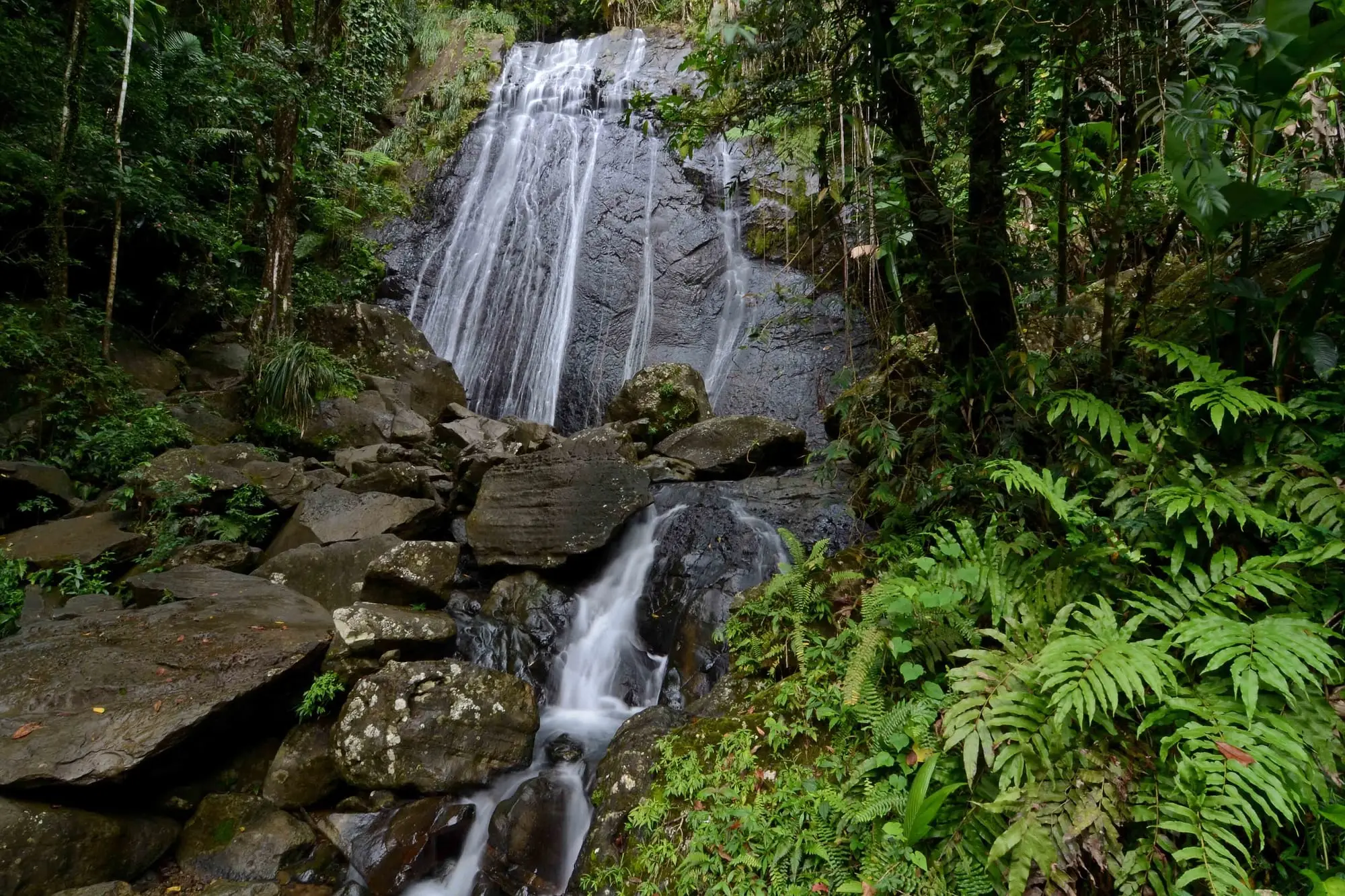
Cascada La Coca
73/100Waterfall · Río Grande · East coastNot verified: Scores estimated from public sources, pending an on-site check: they may change.A tall waterfall right beside the PR-191, the first one you see when driving into El Yunque. A photo stop rather than a place to swim.
- Ease
- Safety
- Access
- 15
Lago Cerrillos
73/100Lake or lagoon · Ponce · South coastNot verified: Scores estimated from public sources, pending an on-site check: they may change.A reservoir among hills north of Ponce, with a recreational area by the dam where families picnic, fish and paddle.
- Ease
- Safety
- Access
- 16
Laguna Santa Teresa
73/100Lake or lagoon · Humacao · East coastNot verified: Scores estimated from public sources, pending an on-site check: they may change.One of the lagoons of the Humacao reserve, surrounded by mangroves, where you can paddle a kayak among birds, iguanas and the occasional caiman.
- Ease
- Safety
- Access
- 17
Salto de Doña Juana
73/100Waterfall · Orocovis · Central mountainsNot verified: Scores estimated from public sources, pending an on-site check: they may change.A tall waterfall that drops right beside the PR-149, one of the classic roadside stops of the island interior.
- Ease
- Safety
- Access
- 18
Cayo Mata la Gata
70/100Reef or dive site · Lajas · West coastNot verified: Scores estimated from public sources, pending an on-site check: they may change.A small cay off La Parguera with shallow, calm water for swimming and snorkeling, reached by water taxi from the village.
- Ease
- Safety
- Access
- 19
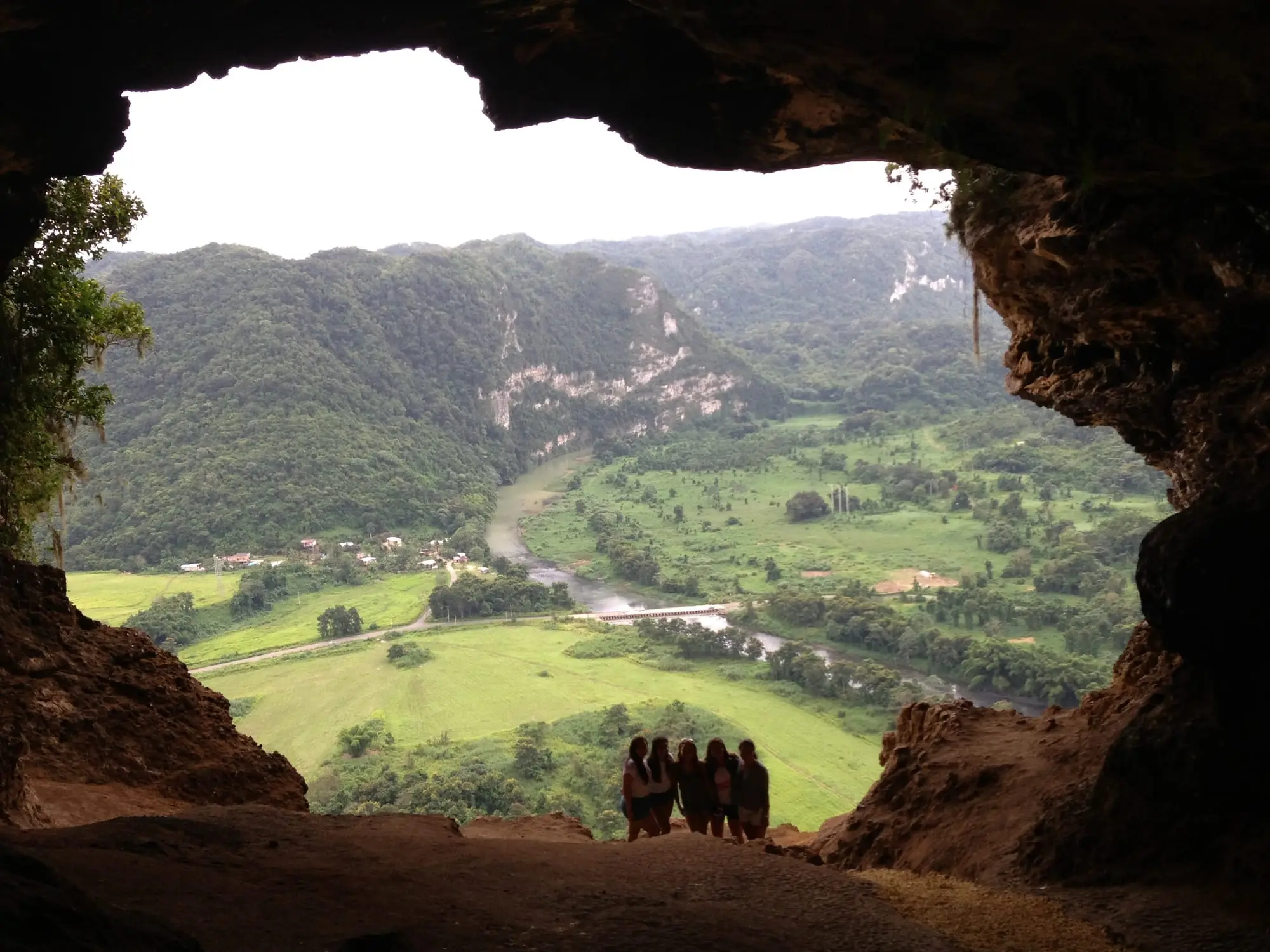
Cueva Ventana
70/100Cave · Arecibo · North coastNot verified: Scores estimated from public sources, pending an on-site check: they may change.A cave in the karst hills of Arecibo whose mouth opens like a window over the green valley of the Río Grande de Arecibo. Visited on guided tours.
- Ease
- Safety
- Access
- 20
Lago Dos Bocas
70/100Lake or lagoon · Utuado · North coastNot verified: Scores estimated from public sources, pending an on-site check: they may change.A reservoir among karst hills between Arecibo and Utuado, next to the Río Abajo forest. Free public boats cross it to restaurants on the shore that can only be reached by water.
- Ease
- Safety
- Access
How this ranking is made
Every place has a score from 1 to 5 for each criterion, following a public rubric, and the score out of 100 combines them with the weights of the profile. Most scores are estimates from public sources; places marked “Verified” have been checked in person.
Read the methodology